How to Access UC San Diego Administrative GIS
Requesting Access
You, or one of your team members, can request GIS access. For each user, please specify:
- First and last name
- AD email address
- Which datasets to access
If consultants do not have an AD credential, the UC San Diego sponsor must submit a ServiceNow request to get one. Then, the consultant must register devices for two-step login with Single Sign-On. Once the AD email is received, contact Diana Henderson to add the consultant to the correct data group.
Contact us if you need more than a viewer license to the dataset(s) or if you need a new dataset or application.
Using a Web Browser
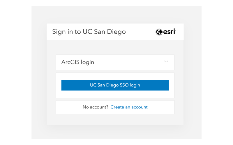
Go to the ArcGIS Enterprise portal, click on the “UC San Diego SSO login” button and use your Single Sign-On credentials to login.
Using the Mobile App
If you would like to use the mobile app, download ArcGIS Field Maps onto your device.
Follow these steps once to access the maps for which you have access:
- Select “Sign in with ArcGIS Enterprise.”
- Add this URL, https://admin-enterprise-gis.ucsd.edu/portal, and login.
Viewing Utilities Information
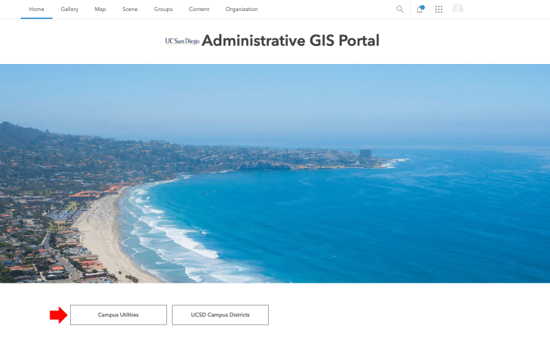
Web browser: From the homepage, click on the Campus Utilities button.
Mobile app: Navigate to the Campus Utilities Stakeholders Group and open the Overall Utilities app.
Zoom in and turn layers off/on to view.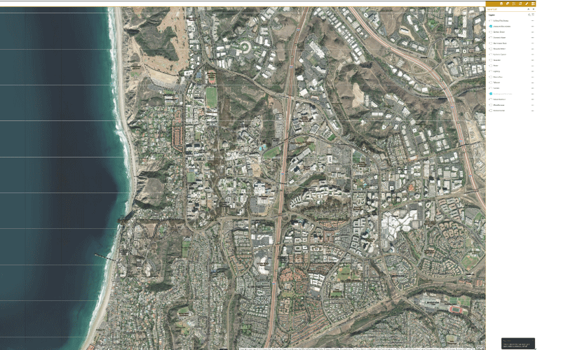
Adding Field Notes
To add/modify utility notes, staff need access to the data and an elevated license on the ArcGIS Enterprise platform. Contact Diana Henderson with this request.
For quick reference, here's how to use a mobile device to login to the utility map to create notes.
Open the Field Maps app and click Sign in with ArcGIS Enterprise when the following window opens.
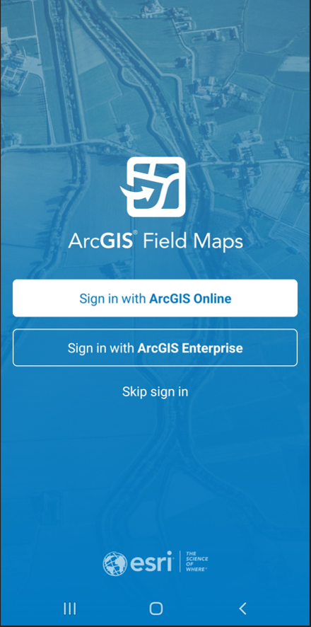
When prompted, add the ArcGIS Enterprise portal address: https://admin-enterprise-gis.ucsd.edu/portal/
Click the UC San Diego login (blue button) and use your AD/password to login (prompts for Duo authentication).

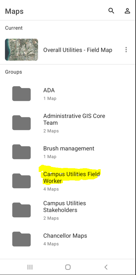
Select the Campus Utilities Field Worker.
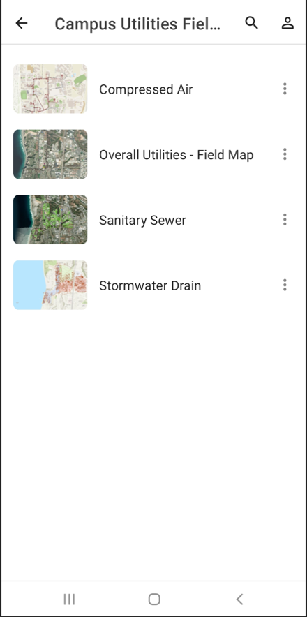
Open the Overall Utilities – Field Maps.
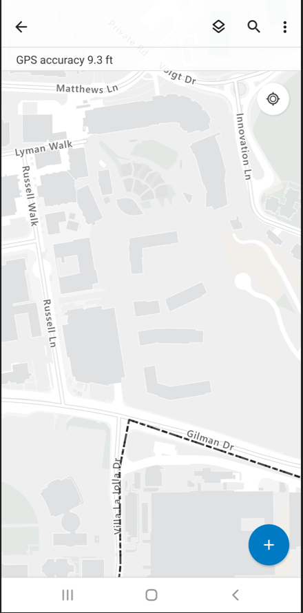
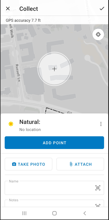
When the application opens, you can zoom to the area of interest, turn on layers (layer icon to the left of the magnifying glass). Click on the blue button with the white plus sign to add a note on the location. (The intersection of the plus is the location where the point will be located.)
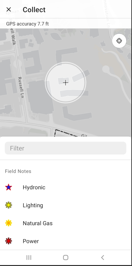
Select the specific layer for which you would like to add a note.
Add your name and a note, take a photo or attach a file (you can also edit this note later on your laptop/desktop), then click Add Point.
Questions?
Contact Diana Henderson.